

“MICIA“

“MICIA“
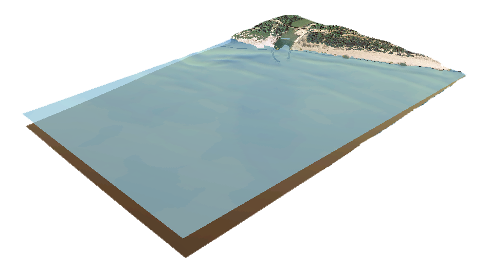
The research activity intends to develop models and functions to be implemented in multiple software that describe the behavior of the Apulian coastal strip in the event of submersion related to sea level rise, floods caused by storm surges and tsunamis. The developed hydrodynamic models will be applied to scenarios in which the sea level variation will have defined a new shore line, with morphological characteristics resulting from the adaptation of coastal systems. Flood modeling will produce different flood maps based on the different hypothesized events.
These products will have a double value:
- Scientific, concerning the development and application of new methods of analysis and integrated survey on the territory;
- Applications, providing a simple and intuitive to read cartographic tool to identify the coastal areas most vulnerable to being flooded by changes in sea level, storm surges and tsunamis.
PARTNER:
- Università degli Studi di Bari Aldo Moro
Dipartimento di Scienze della Terra e Geoambientali - Aix-Marseille Université, CNRS CEREGE
Aix en Provence, France
Ente Finanziatore
Borsa di Dottorato Industriale Programma Operativo Nazionale FSE-FESR Ricerca e Innovazione 2014-2020 (CCI 2014IT16M2OP005), Fondo Sociale Europeo, Asse prioritario I “Investimenti in Capitale Umano” - Azione I.1 “Dottorati Innovativi con caratterizzazione Industriale” - Dottorato in Geoscienze - Ciclo di Dottorato XXXII
Periodo
Marzo 2017 - Marzo 2020